Chain Lakes Loop Trail in Mt. Baker
In this post, I outline everything you need to know about hiking the 6.2 mile long chain lakes loop trail in Mt. Baker.
Getting there
About an hour from Bellingham, Washington, 2 from Vancouver, BC and 3 from Seattle, the Mt. Baker recreation area is an incredible hidden gem in northern Washington. The road up to the famed ski resort of the same name is a narrow, winding road through temperate rainforest, along the gorgeous Nooksack river, and up the mountain to the ski resort. There’s not a lot of lodging along the way (most accommodation nearby is in Bellingham), though there is a lodge or two at the resort itself as well as two campsites (Silver Fir and Douglas Fir) maintained by the park service. Make sure to bring some snacks with you before you leave for a hike in this gorgeous area as food options are scarce!

Hikes around Mt. Baker
The fantastic thing about the Mt. Baker recreation area is how well maintained and labelled the hikes are, and how there is so much variety in both accessibility, length, and difficulty for many hiker types. You can hike half a mile to an amazing viewpoint of Mt. Shuksan with a lake in the foreground at Picture Lake – it’s partially paved and is wheelchair and stroller accessible. Or, you can do a 12 mile hike along Ptarmigan Ridge. At Mt. Baker, there’s something for everyone.

Chain Lakes Loop Trail
We opted to do the Chain Lakes Loop Trail for a few reasons:
1) it’s dog friendly
2) it’s a loop – hard to come by!
3) lakes and views the whole way
4) moderate (for us) length and elevation gain.
Since it’s a loop, you can choose which direction you want to start in. We went clockwise from the Artist Point starting point. The advantages of this are that you start with the best views, and you ultimately breakup the uphill portions of the hike. The advantages of going the other direction would be having Mt. Baker in front of you almost the entire way.
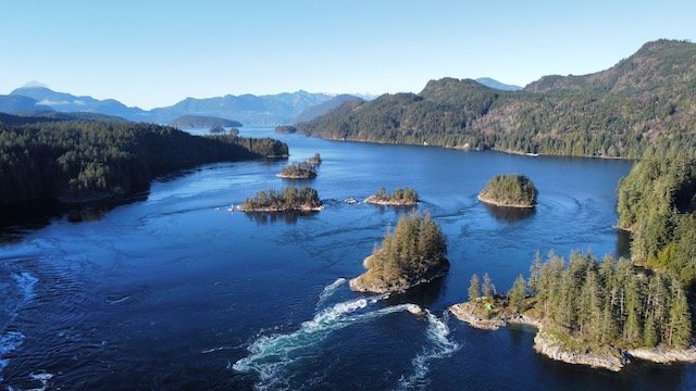
Along the hike, you follow a well maintained narrow ridge walk, descend down to visit 4 different lakes – 2 of which are partially snowmelt fed and therefore a rich, aquamarine blue color – and the entire way, you enjoy various views of Mt. Baker and Mt. Shuksan. We visited in October and enjoyed cooler temperatures and fall foliage as well, which was a treat.
There are really no obstacles on this hike, and if the distance and elevation gain are a non-issue for you, it’s somewhere in the easy to moderate range as far as trails go. It took us almost 6 hours though because we kept stopping to take photos and enjoyed a leisurely lunch next to one of the beautiful lakes.

Other things to know
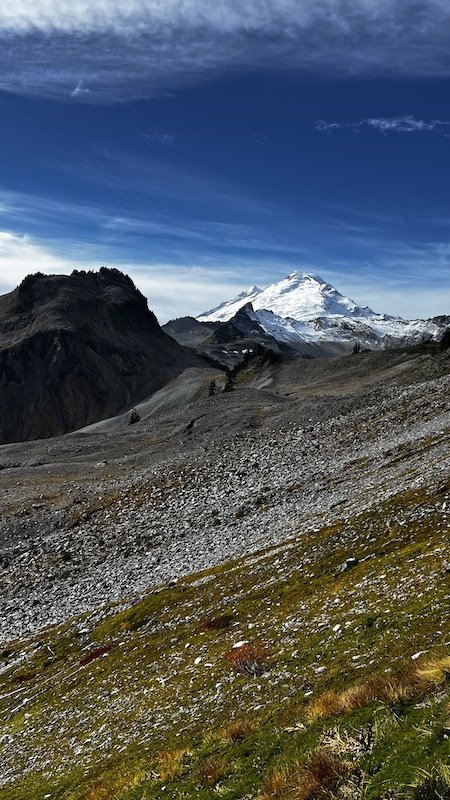
- It’s a bit of a misnomer to say you’re hiking Mt. Baker – the actual stratavolcano that looms over Northern Washington that can be seen from as far away as Vancouver Island on clear days is a very technical, mountaineering objective – and the hikes in the Mt. Baker wilderness and national forest have views of the mountain, but are not actually ON the mountain. Also, don’t get confused – there is a sister stratavolcano across from Mt. Baker called Mt. Shuksan – also enormous and quite beautiful!
- There are multiple entry points to the Mt Baker / Snowqualmie wilderness, and they are far apart – so double check that the hike you are going to is in the right area – this article primarily talks about hikes that originate at the Mt. Baker Ski Area / Artist Point. Alternatively, you can access hikes in the same national forest from central coastal Washington (near Everett).
- The elevation at Artist Point starts at 5100 ft – be mindful of this if you are sensitive to altitude.
- If you get out of your car at Artist Point, you don’t even need to go on a hike to take in some incredible views of the surrounding mountains – consider this if you are short on time or have accessibility issues.
- Downtown all hikes offline before heading out – there’s no cell service.
What to pack
Check out my day hiking list to get inspired on what to bring when attempting this hike. Also, never forget your 10 essentials so you can recreate outdoors safely!