Backpacking to Norway’s Trolltunga
Norway offers so much to explore in it’s vast landscape. In this post, I’ll be sharing important information about how to create an amazing multi-day backpacking trip in beautiful Hardangervidda National Park that ends at the gorgeous Trolltunga hike.

I wrote a play-by-play diary style post of my experience backpacking in Norway, and the popularity of that post has led to this one given the demand for more details on exactly how to plan and the logistics of such a trip. If you are in need of packing advice, you can also find that in my How to prepare for a hiking trip in Norway post. And, because you might find yourself in Oslo on either end of your hike, here’s a 1 day itinerary for Oslo.
Why Go To and Where is Hardangervidda National Park?
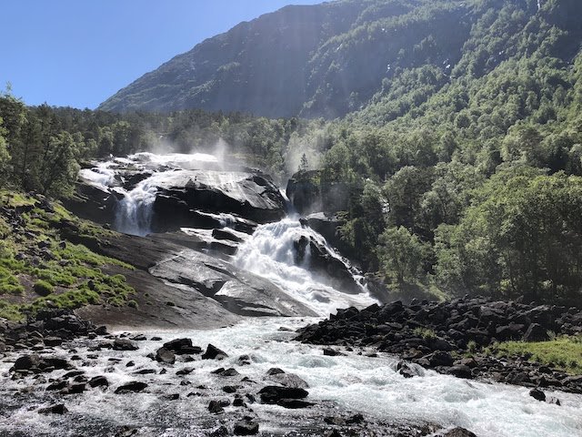
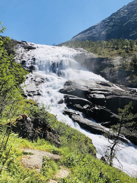
You may not have heard of Hardangervidda before, but I promise you it is a hidden gem worth exploring. It’s the largest national park in Norway, and offers vast, untouched beauty that is easily accessible by public transit. It has one of the largest herds of reindeer on the planet. And it’s miles and miles of untouched, unspoilt waterfalls, lakes, streams and mountains every way you look. I didn’t encounter a single other tourist on this hike until I reached Trolltunga, so if you are looking for a place where the Norwegians hike, then this is for you. Oh and maybe one of the most important notes – you get to enjoy an incredible backpacking adventure, and end it with the incredible Trolltunga vista! Most tourists don’t get to see Norway like this.
Hardangervidda falls right in the middle of Bergen and Oslo, so makes for a great adventure in between visits to those popular destinations in Norway.

What’s the hike?
This is a ~50 mile loop that essentially follows the following trail Kinsarvik > Stavali hut > Torehytten hut > Tyssevassbu hut > Trolltunga > Tyssedal . Here’s an Alltrails link which describes the trail. I’ve also submitted a public trail to AllTrails that once approved, should have more data on the conditions.
Given the mileage of this hike, a strong fitness level is recommended. However, the speed at which you do the hike and the number of nights on the trail can make a big difference in making it easier or harder. I did it in 4 days, 3 nights, which was too fast. I wish I had done it in 4 nights, 5 days at the minimum.
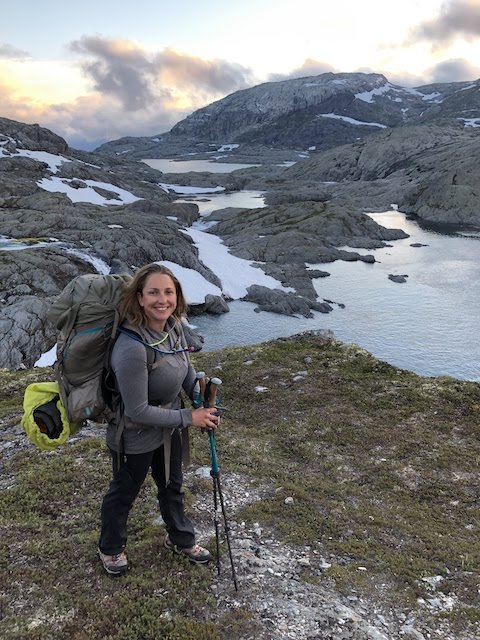
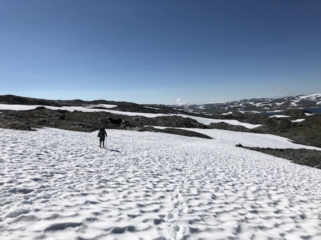
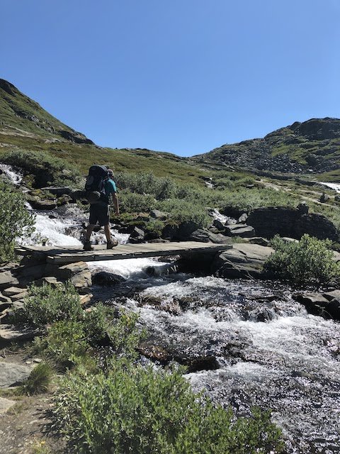
The hike is hard at the beginning and the end primarily, given you have to climb up 3,000ft in 5 miles to reach the plateau (and then hike back down which is hard on the knees!). While up on the plateau, the terrain is more variable and manageable, primarily remaining at the same elevation.
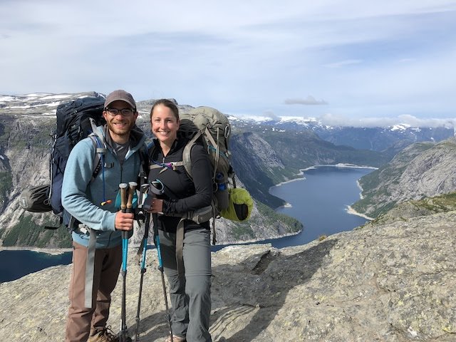
This hike ends at Trolltunga, giving you a magnificant cherry on top of an already epic adventure.
When should I go?
Summer is the time to hike in Norway. I did this hike in late June, but there was still snow. Depending on the snowpack for the year, you may want to start in July or August to avoid snow hiking. You can check the weather in Norway using Norway’s government weather app. In the winter, this area is popular for backcountry skiing!
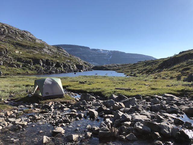
Where can I camp?
The best thing about Norway is that you can cowboy camp! That means, you can camp anywhere you see fit. They have laws that allow for roaming on uncultivated land (the ‘right to roam’ or ‘allemannsretten’). That’s why you can decide for yourself how hard or easy to make this hike – it just depends on how many nights you want to sleep on the trail.
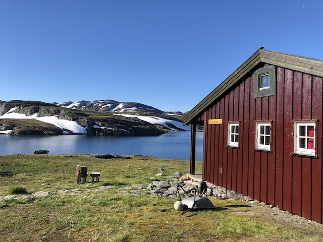
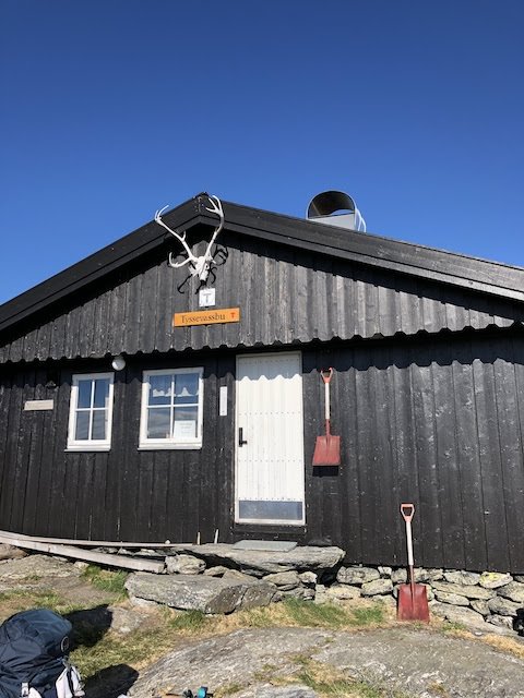
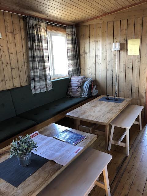
There are backcountry huts along this route as well. Some offer overnight accommodation, while others offer food or a pantry. I didn’t stay in any of them but did visit each and picked up some food and snacks along the way. Here are the huts encountered on this trail:
The links above have information about when the huts are staffed, reservations, and more.

Do I need permits to hike?
Nope! It’s a huge park, and since you can camp anywhere, overcrowding isn’t an issue.
How do I get to the trailhead?
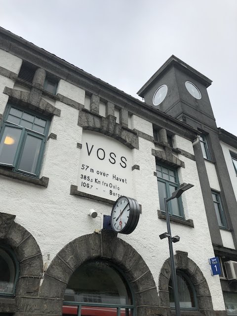
The best thing about this hike is that it’s accessible by public transit. Coming from either Bergen or Oslo, along the main train route that connects the two cities east to west. You can plan your trip using Vy. Almost all routes will have you depart the train in Voss, and board the 990 bus headed toward Odda. You can get off in Kinsarvik and start your hike! We did have to walk a few miles in the town to get between the bus stop and the trailhead, but you could also hitch a ride or get a cab to save you time there.

Where should I stay before and after the hike?
When I did this hike, I woke up early in Bergen, took the train and bus, and then started the hike. However, you could spend the night in Voss or in Kinsarvik so that you can hit the trail first thing in the morning.
I ended the hike in Tyssedal, which you can stay in, or head to Odda, which has a few restaurants. From either town, you can take the 990 bus back to Voss and head back to either Oslo or Bergen (or beyond!).
When I travel I always book with Booking.com – check out some options!
Important safety notes and things to keep in mind
- Maps of Hardangervidda track distance in time, not in kilometers. I found this quite deceptive – time seems to be relative to the speed of a very fit, very fast Norwegian man. Hikes that said they were 6 hours took more like 10. Please take this into consideration when planning your trip.
- In the summer in Norway, there is sun until 11pm some months. Take advantage of this to hike!
- Bring enough food for your journey. Even though you can buy food at the huts, they may not operational when you are there.
- Bring a filtration system for your water.
- Bring a map, satellite phone and GPS device. You’re in the backcountry, and are quite far from help if you need it. Also, sometimes the trailmarkers (bring red “T”s) are obscured by snow or are faded, which can make routefinding challenging. This isn’t the only trail on the plateau, so check you know where you’re going!
- If you camp near Trolltunga, make sure to get to the overlook as early as possible to beat the usual crowds for a photo op. This is the only busy part of the trail, since day hikers come up from Tyssedal.
What should I bring?
I have a roundup of my go-to backpacking gear here, or you can check out my day hiking list. Never forget your 10 essentials! Always check the weather report before setting out as well, and be prepared for changing conditions.
Is this too much?
If this hike seems more than you can chew, there are a number of day hikes in the area you can explore from either Kinsarvik or other towns along the 990 bus route – you can explore them all at Komoot. Or, you can hire a private guide to take you hiking to Trolltunga.